
-
Recommendations for “truck” GPS?
Posted by Charlie on December 16, 2016 at 2:53 pmHi All,
I got myself into potentially serious trouble yesterday driving a friend to La Guardia airport in my ’98 XL. Following my nav, I wandered onto a parkway for “non commercial traffic only”, and was shortly confronted by a bridge noting a 10’8″ clearance… All this in the middle of swarming and angry NYC traffic with no ability to exit or turnaround or back up…
I typically use Apple Maps for my GPS guidance. Can I receive some advice for what I should be using to be guided only on truck-friendly routes? Apple Maps has no such feature. It is one thing to risk getting a ticket on roads noting “no commercial traffic” (which I’m not), it is another thing entirely to shave the top of the bus off thanks to a bridge…
Greg replied 9 years, 9 months ago 12 Members · 22 Replies -
22 Replies
-

I have been very pleased with a Garmin RV760LMT. I think it will do what you need.
-
As you know now, all parkways are a no no in NYC. Every GPS and mapping software I use sent me down a parkway after I crossed ThrogsNeck bridge last August. It was after midnight and I refused to get on the parkway much to Mr. Garmin’s surprise.
Getting caught on there in a bus could be thousands in towing and fines according to their website. It is “Passenger cars only.”
I thought I had done due diligence in preparing for NYC but that is one thing no one told me. Once I googled “parkways in NYC” it all be came clear. Surely some GPS units know this but mine did not.
Davy
-
How did you solve the problem? Did you make it under the 10-8 bridge?
Wouldn’t you take the GW and head for the Tri-Boro and follow the signs to LaGuardia? I recall there being truck traffic on that route.
-
I third the Garmin RV760LMT but will double check against a truck route map if I’m in a busy area.
-
I’d like an app for my iPhone rather than another standalone device, but so far I haven’t found any apps with universally good reviews for accommodating “no fly zones” for our coaches (height and weight, primarily).
As for the 10’8″ bridge, I pulled over to the side of the road pissed, but not as pissed as everyone behind me. I was coming from Eastern Long Island, not GWB/Throgs Neck (that’s just my normal commute TO Long Island with the bus – which is perfectly safe for buses other than traffic). I sat there weighing my options about 50 yards short of the brige. After some careful consideration, I decided the 10’8″ warning was for the lowest point and the bridge was a shallow arc. I wagered the top of the arc was about a foot higher than the outer parts so after pissing off a lot more people, I got back onto the highway and drove in the middle of two lanes (in between two lanes, I guess you’d say) so that I was centered under the arch. I know my bus is about 11’4″ lowered. I have not yet measured its normal ride height – a major problem.
By a stroke of God that worked and then I was also lucky enough to immediately be at an exit for Citi Field (home of Mets, they must have coaches that go in there, right?). I then drove all over places that probably don’t see Prevost Coaches very often and found the proper truck route to LGA. LGA itself was an entire mess. It is under construction, packed, and has its own height warnings for some terminals. I evenutally kicked my passenger out at the wrong terminal just so I could escape the madness. I was thrilled, ironically, when I was safely back on truck-infested highways in stop and go traffic with Jersey barriers everywhere and no space on either side – but at least not about to be decapitated by a bridge.
-
I use the Rand McNally 7720 GPS. Designed for trucks and RV use. Has a 7″ Screen and built in battery.
Have really liked it and all its routing options.
You can also download custom POI (Point of Intrest) files from some websites like Low Clearances, WalMarts, Truck Stops, Dump Stations, Rest Areas and much more.
Here is the website address, http://www.poi-factory.com
Really good database.
-
Ditto the Garmin 760, it’s the best. Even BA just took delivery of a 760 after being disappointed with a new Rand McNally.
-
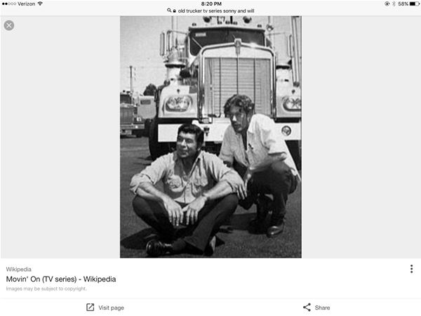
Sonny Pruitt just turned over in his grave. I expect that from BA but you Truk?
Oh my.
Later
bv -
If you order a Garmin 760 add this bean bag mount. It works as advertised. With the windshield GPS suction mounts I had interference when putting blinds down.
Where ever you put this on dash it stays put. GPS snaps into ball socket also has additional adjustments.
-
App for IPhone is Copilot RV, as they have differant ones…You can set rv dimensions including weight….
-
I use Buddy’s Rand McNally 7720 GPS, I have been pleased in it has not let me get decapitated or fall into a creek.
you set length, height, and tonage, etc.
It’ does some funky routing at times (tried to sent me thru a gated community once) and so I always do a google earth preview.
there is an ipad app version available
-
I use the Garmin 760 and have a POI (points of interest)
download called Low Clearance that warns me of height. You can set to warn any distance ahead. I have mine set at 20 miles so I can find a
detour in time. In addition, I use a
free download called Waze (ways) on my smart phone that does not charge data
and is up to the minute on routes, traffic flow, police, work crews, etc. It will notify you if someone added where a
police unit is located, as you go by if the cop is not there, you can delete
it. It shows traffic flows, back ups, etc. You can add, cars on the side or
road, hazards, almost anything. With the two I use Waze with the Garmin as a
backup.Sorry, Jon but I finally got rid of my flip phone, my giant 20
inch B&W TV, my house rotary dial phone and moved into the 20th century. However the latest of my three automobiles is 14 years old,
so that should count for something. -
Bernie,
If Sunny and Will were here today the 760 would be on the dash right beside the Linear and the rubber duck.

Log in to reply.