
-

Jon,
I live in “southern” Illinois. There are striped goat paths here too. I guess I thought I was driving my 4X4 Duramax. The Illinois version of the GPS has an Illinois Governer saying “Trust Me!!!” You can make down this road……… -
Last time out to west texas came upon a long trucking load stuck in a ditch on side of road trying to turn around. They (pilot car) figured out from GPS they were heading the wrong direction and tried to turn around. The Trucker, as I stopped to giggle (in my mind) told me he was going to stick that GPS unit up that leaders butt if he could catch him. I know they are helpful though but I’ve got one built in, in the seat next to me. But she fusses when I make the wrong turn.
-
A couple years ago when we buried my Pop we had to stay at Katherines Landing in Hot Springs AR. A nice fellow from New Orleans pulled in a row behind us and one over in a brand new Newall.
I saw him the 1st day walking around his coach looking pissed off and sitting at the picnic table staring at our bus and trailer.We finally struck up a conversation and he asked me about my setup and was very complimentary. He asked me how I got into the park and I told him I got off the ByPass made 2 lefts and a right.
He turned to me with a blank look and said I made 2 big mistakes. He said my brother owns a bus and I’ve been staring at yours for 2 days and why I bought this Newall I don’t know and on the way in here I followed the GPS off INT 30 and it ran me down a 2 lane I couldn’t get off or turn around and ripped the top of my coach to shreds, scratched the sides and took some antennas.I tried to comfort him and told him what I tell most folks, 99% of the stuff that happens to us is self inflicted. I made a friend that day and I bet next time I see him he’s driving a bus.
Later
bv -
Like Jon and others we don’t rely exclusively on the GPS (we used too) when planning a trip. I have a Rand deluxe motor carrier map-set that I check to be sure the route we intend to take is an approved big-truck route whenever we will leave the Interstate system.
In addition I downloaded the Lowclearance info to the Garmin that so far, has alerted us to any low bridges in the vicinity well in advance.
When it comes to off-Interstate directions, the Garmin RV760 has on several ocasions been a disaster.
-
It
was nice seeing your post asking about the best GPS unit. Here is my two cents regarding GPS and
digital maps, and getting safety where you want to go. I have driven and flown with Garmin GPS for
many years – Garmin makes a good GPS, but because of cost (the unit, map
updates and traffic subscription), map accuracy, and not wanting to buy another
electronic device that only performs one function, I have made a change. I now use
my tablet (with WiFi) and Google Maps.
The tablet sits perfectly on my dash and doesn’t obscure my view. For added safety and to help not distract me,
I use Google Maps in Energy Save Mode.
This keeps the screen black until I am three miles from my next turn –
this is very important for me at night.For
me, using Google Maps is best for several reasons – accurate updated maps, very
accurate traffic info, satellite imagery and cost. One important drawback is you must have
internet, or save the needed maps before you drive to a desolate area. Those of you that are concerned about data
usage – don’t be, it is very minimal. Another
big plus is I already own a tablet and use it for many other tasks. Just
my thoughts on what works well for me. But
wait, there is more.John
mentioned a very important point about map study. I learned in Undergraduate Pilot Training the
importance and the value of “flying” my mission before I ever stepped to the
aircraft. I am following the same
routine, and do the prep work, before
leaving on a trip with the bus. I look at the satellite imagery and Street View
to confirm where I am going and make sure I don’t exceed my driving abilities. Most of my miles are on the highway, not much
concern there other than traffic and construction, so most of my attention is
paid to my stops and travel on secondary roads.
And as mentioned earlier, a very thorough route and arrival study can be
done with the same tablet I navigate with and watch Netflix on.Google
Maps is a great tool – works for me in most applications. Use what suits your needs, situations, and preferences.
-
Co-Pilot.
It is available for the iPhone/iPad/Laptop and you can use it offline because you download the maps to your device.
Another point of interest to know about is the fact, that the mapping information that you view on a Garmin, Rand McNally etc. may be coming from the same source.
There are a couple of mapping providers which sell their data to the GPS manufacturers.
The GPS manufacturer package that data their way and that is why you see different looking screen layouts.
Anyway, just wanted to throw this into the discussion.
Cheers,
Ronald
-
I love my Good Sam’s Rand McNally 7730 as the main GPS. It gives me routes that are safe for the length and height of the bus. It also tells me where Pilot, Flying J, Walmart, and other places are that I use. It gives me weather, fuel prices, and much more too! But I also run Waze on a 7″ tablet that gives me real time user updated information on road closures, traffic, accidents, police, and more. It’s free and is a perfect companion to your normal GPS. Actually, it could handle your GPS needs all by itself, but for the RV specific issues. When I am in my truck, even though it has built-in Nav, I use Waze for my GPS needs.
Edit: Waze uses internet data. If you run it on a tablet like I do, you’ll need an Internet hot spot. I have that in the bus, so it’s no problem. In my truck, it uses data from my cell phone. If you don’t have a large or unlimited data plan, you’ll lose some of the functionality of Waze.
-
3F you’re on fire tonight. Best GPS response yet. Didn’t think anything could beat your Marathon Handbook. Did it come with your coach? 😉
-
Thumbs up on my experience with the WAZE app on the smart phone. Very impressed with the accuracy and the info regarding road hazards, vehicles stopped on shoulder, even updates on traffic jams, construction, and law enforcement.
I often use two GPS when travelling in the bus- because I have first hand experience with running out of road and having to unhook and back out. Not much fun. The WAZE app generally gives instructions prior to the Garmin ond Buddy brand GPS. To each his own but those of you who have smart phone should try it- its free.
-
Since day one of using a GPS, I’ve let common sense, a compass, and my recollection of looking at a map (hard copy or on-line) override the GPS quite often and I’ve saved ourselves from bad route often.
That said, I do find taking the GPS out onto Lake Winnebago when its well frozen over during the sturgeon spearing and observe it trying to get up back to “dry land”. In the Suburban of course … not the Prevost.
During my college days when I was in the airplane business during breaks, holidays, and over the summer, the guy I worked for had individual state highway maps in his airplanes and sectional charts in his pickup truck which I used quite often (including two round trips from Wisconsin to Florida). The jux position of the maps/charts made for some interesting navigating experience. I have to admit that when using his Super Cub on floats I actually found the highway maps awfully handy since the Cub’s primative radios never seemed to work when I flew the airplane.
-
nobody mentioned nobody mentioned DeLorme GPS. I have used the product for several years with excellent results . You don’t need Internet connection that one drawback is that updates every year or two cost more money . That said DeLorme of 2008 is still relatively accurate for routing and once you learn how to use it pre-routing a trip is easy and they have wireless trans ponder or location mounting convenience
-
Main use of my GPS………………..
……very accurate speedometer.
Newly installed speedometer is (almost) impossible to calibrate as tight as the GPS……
(I meant impossible for me to do!! ……..is daunting a real word?)
…………Ol’Ben
-
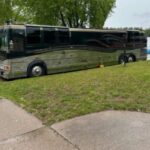
One of the things I don’t understand about the two GPS’s we’ve got (older Garmin and now the JVC, I think, navigation system on the coach) is that they don’t appear to automatically switch from one time zone to another and TELL ME what time zone is being displayed. I find that awfully strange and frustrating.
Anyone have a GPS which will do that?
-
One thing to keep in mind when you buy a GPS unit… Most of them come with free lifetime updates now. The first thing you should do, even with a brand new GPS, is take it in and hook it to your computer and update it. It could have been months since your GPS was manufactured and shipped to a store. And it could have sat there waiting for you to buy it. Updating my Good Sam’s Rand McNally GPS made a world of difference. It is not just the maps that get updated Of course, that is one of the benefits of using Waze, Google Maps, or other online sources… They update continually. I try to update my Rand McNally about every month or so.
Log in to reply.